By Robert B. Case, PE, PhD
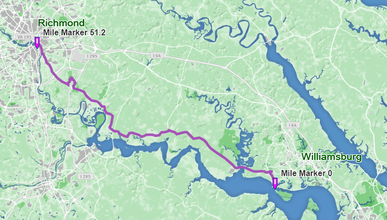
With over a half million users per year, the Virginia Capital Trail (VCT)—a paved trail opening in 2015 that starts in Jamestown and runs approximately 50 miles northwest to downtown Richmond—is perhaps the premier trail in Virginia.
Virginia Capital Trail
Source: virginiacapitaltrail.org
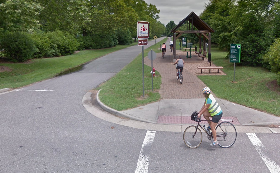
The trail begins near the Jamestown Settlement complex at a gazebo with bike repair equipment.
Trailhead near Jamestown
Source: Google Maps
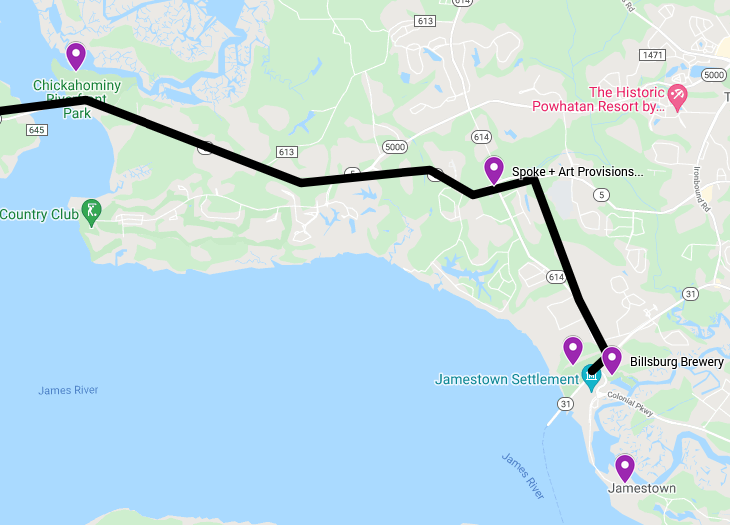
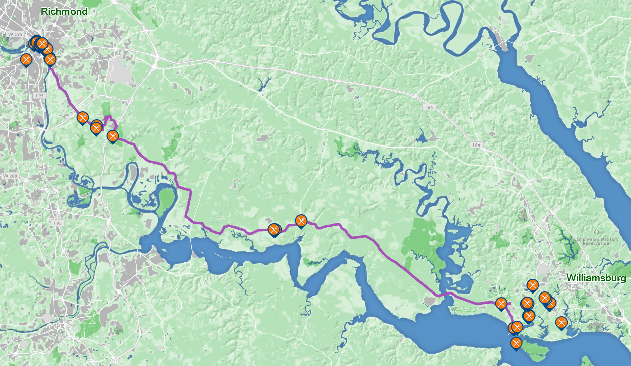
In James City County, the VCT joins neighborhoods with several interesting destinations:
- Jamestown (original fort and excavations)
- Jamestown Settlement (museum, recreation of colony, replicas of ships)
- Billsburg Brewery- near trailhead
- Spoke + Art Provisions (food, bike supplies)- 2 miles from trailhead
- Chickahominy Park (pier, campground, pool)- 6 miles from trailhead
Virginia Capital Trail- James City County portion
Source: HRTPO via Google My Maps
For those traveling longer distances, two restaurants lie approximately half-way to Richmond:
- Cul’s Courthouse Grill- 20 miles from trailhead
- Indian Fields Tavern- 22 miles from trailhead
and many restaurants lie at the Richmond end. See official website map for restaurant details, plus camping, bike repair, convenience stores, etc.
Restaurants Along/Near the Virginia Capital Trail
Source: virginiacapitaltrail.org
Between crossing over the Chickahominy River (mile 6) and passing under I-295 (mile 40), the trail has a beautiful, rural character.
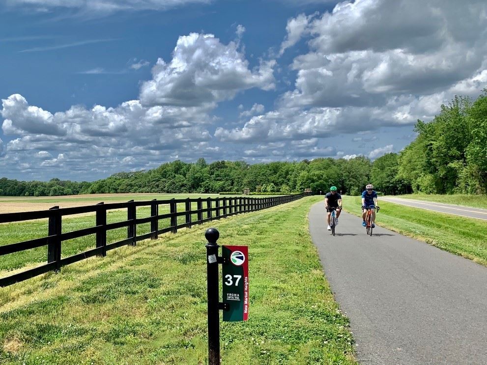
Rural Nature of Virginia Capital Trail
Source: VCT Foundation
At the Hampton Roads end of the Virginia Capital Trail (black line), other facilities enable branching off the trail:
- Colonial Parkway (green line; low volume road between Jamestown & Williamsburg)
- Powhatan Creek Trail (blue line)

Existing Facilities Connecting to the Virginia Capital Trail
Source: HRTPO via Google My Maps
And VDOT, HRTPO, and local governments are planning proposed trails (orange lines) to extend the Virginia Capital Trail to Williamsburg, Yorktown, Newport News, and Hampton’s Fort Monroe on the Peninsula, and to Surry, Smithfield, Suffolk, Chesapeake, Portsmouth, Norfolk, and Virginia Beach’s oceanfront on the Southside.
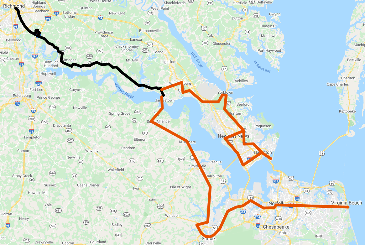
Proposed Trails Extending the Virginia Capital Trail
Source: HRTPO via Google My Maps
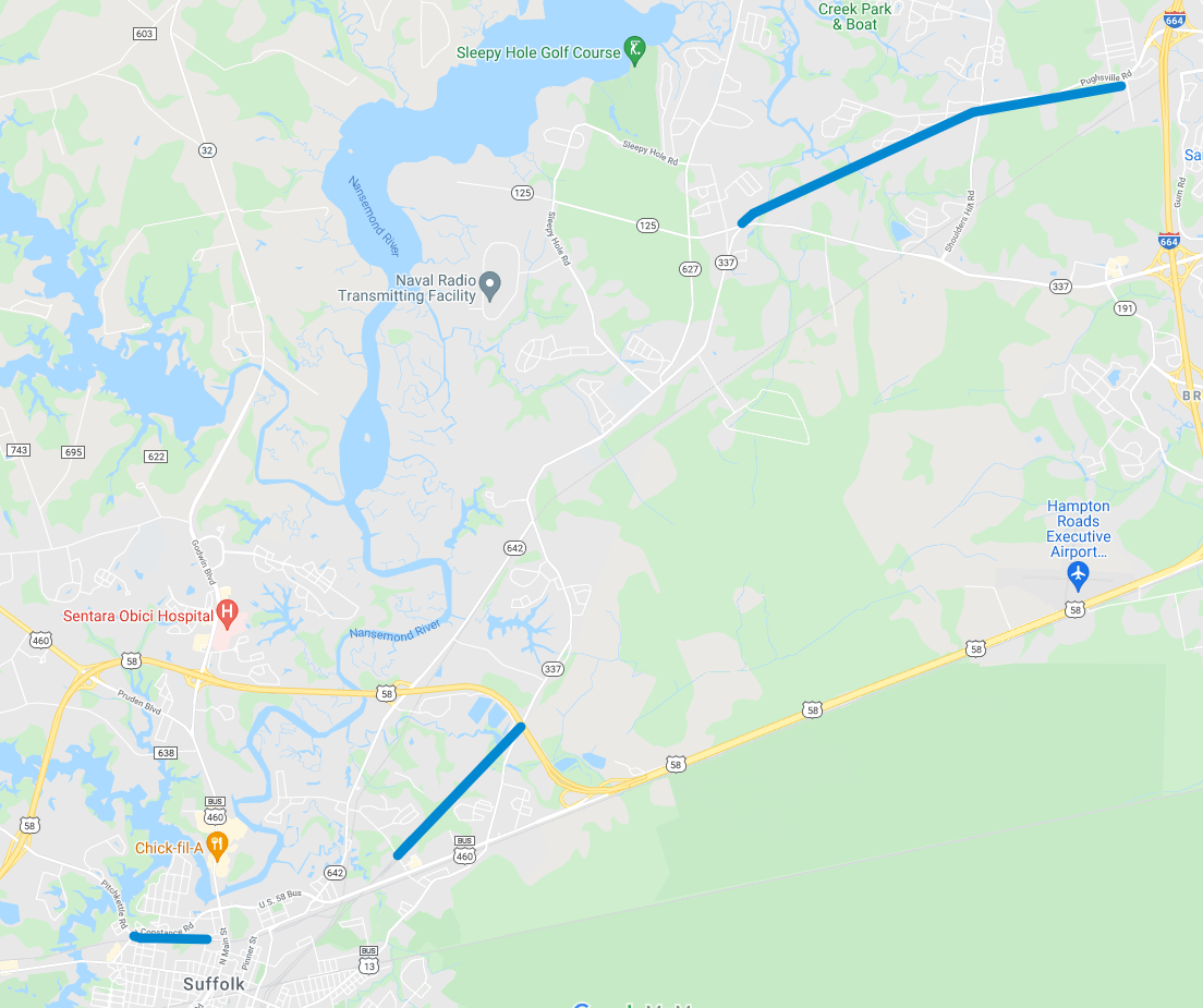
Significant portions of this trail system already exist in Suffolk (as shown below):
- A path along Prentis Street downtown
- A rail trail between Suburban Dr and Nansemond Pkwy (Rte 337) east of downtown
- A rail trail between Nansemond Pkwy (Rte 337) and I-664 in northern Suffolk